Cartes géographiques et atlas
- 235 Atlas
- 5558 Cartes géographiques
- 203 Plans
Date de sortie
- tous
- 5981 publiés
- 153 moins de 3 mois
- 60 moins d'un mois
- 15 moins d'une semaine
- 55 à paraître
- 6 dans la semaine qui vient
- 31 dans le mois qui vient
Disponibilité
Prix
- 75 inférieur à 5 €
- 946 de 5 à 10 €
- 2663 de 10 à 20 €
- 2310 de 20 à 40 €
- 97 supérieur à 40 €
-
-
-

-

-
-
-

-
-

-

-
 Top 25 : une carte, un site, 2644OT, 2644Ot Pezenas-Murviel-Les-BeziersXxxIGN – Institut Géographique National13,90
 -
-

-
![[France] départementale, routière et touristique, D11-81, D721308 Aude.Tarn](https://storage.gra.cloud.ovh.net/v1/AUTH_3877b9485d06455c8b7c11a9fadaeb2d/attachments/medium/6/9/9/011813699.jpg) [France] départementale, routière et touristique, D11-81, D721308 Aude.TarnXxxIGN – Institut Géographique National5,90
[France] départementale, routière et touristique, D11-81, D721308 Aude.TarnXxxIGN – Institut Géographique National5,90 -

-

-
 Top 25 : une carte, un site, 2643ET, 2643Et Clermont-L'HéraultXxxIGN – Institut Géographique National13,90
 -
 Top 25 : une carte, un site, 2347OT, 2347Ot Quillan.Alet-Les-BainsXxxIGN – Institut Géographique National13,90
 -
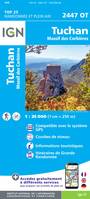 Top 25 : une carte, un site, 2447OT, 2447Ot Tuchan.Massif Des CorbieresXxxIGN – Institut Géographique National13,90
 -

-
 Top 25 : une carte, un site, 2444ET, 2444Et Somail.Minervois.Saint-Pons-De-Thomieres.PnXxxIGN – Institut Géographique National13,90
 -
 Top 25 : une carte, un site, 2343ET, 2343Et Castres.Le Sidobre.Pnr Du Haut LanguedocXxxIGN – Institut Géographique National13,90